Personal heatmap

The roads you ride most

Every ride you record is drawn onto the map, and the more you ride a road, the brighter it glows. After a season you can see where you have been, and where you have not.

See how the map fills in
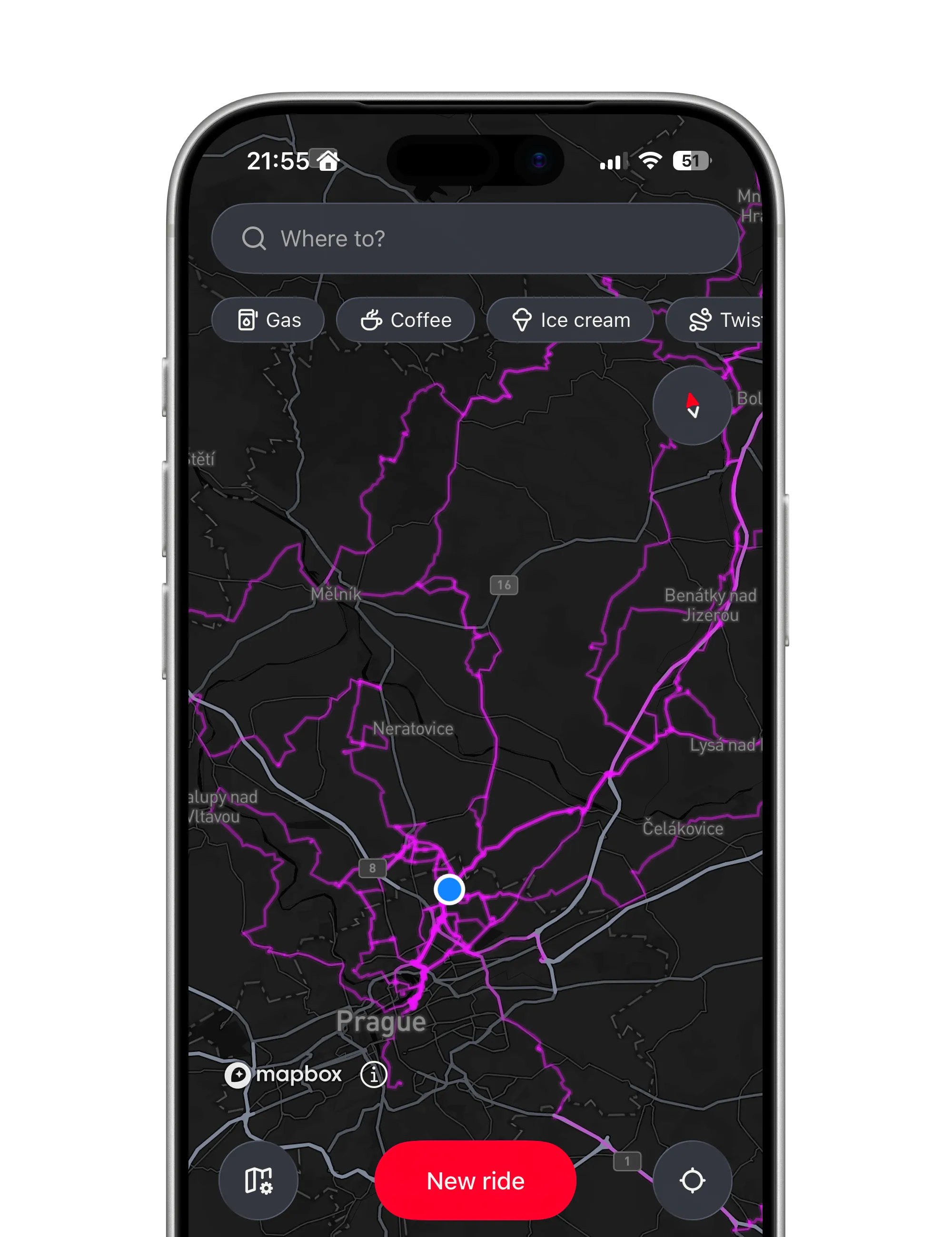
The personal heatmap on the dark map: every road ridden around Prague and north of it glows purple
  • Brighter means more. A road you ride every weekend outshines one you rode once.

  • Only rides you rode. Recorded rides count; planned routes and imported files never do.

  • Yours, on your phone. Built on the phone from your own rides. No signal needed to see it.

A list of trips tells you what you did. A heatmap shows you the shape of where you ride, and the blank corners of the map you have not reached yet.

How it works

How the map fills in

Rides recorded on the road, matched onto the asphalt, stacked up over a season.

Matched to the road, not the wobble

Your rides are lined up onto the roads you rode, not the GPS scatter beside them, so the map reads as clean lines on the asphalt.

  • Every bend, hugged. Zoom in and each road follows its curves.
  • Off-road stays as ridden. A field or a trail the map does not know keeps your raw line.
  • A parked bike is a point. Minutes standing still become one dot, not a tangle.
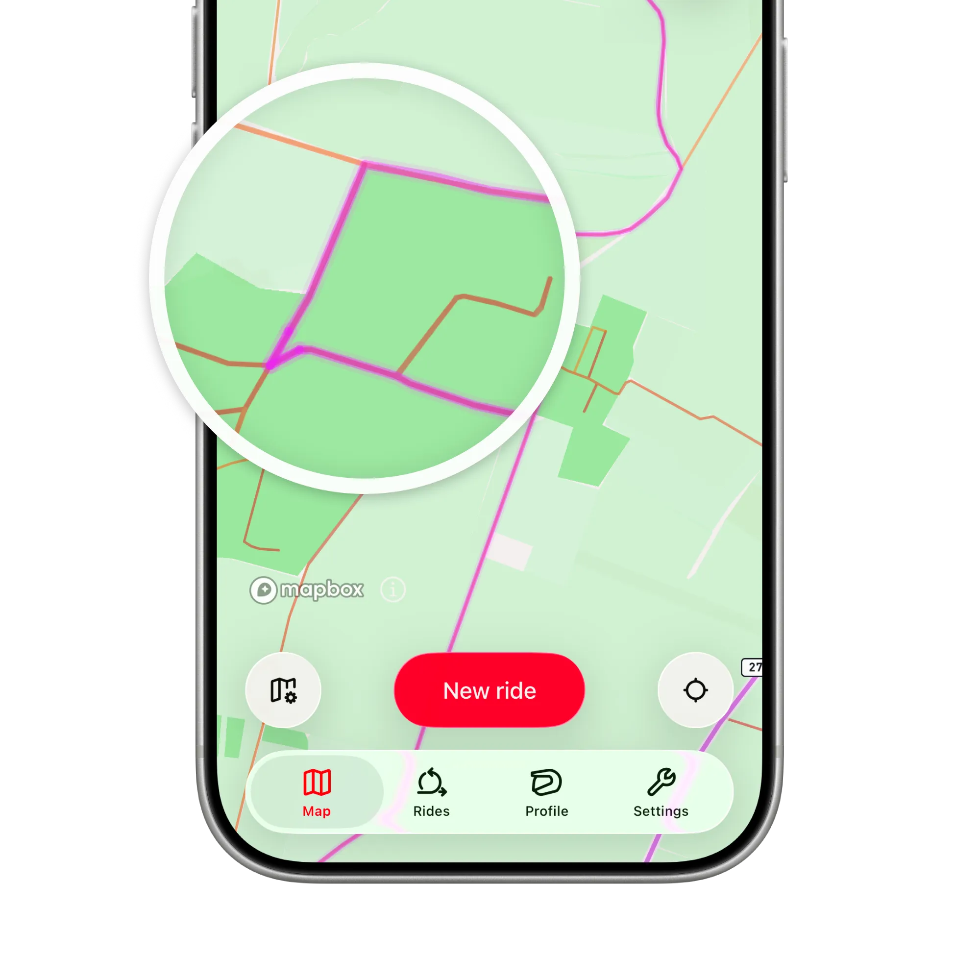
A magnifier over field roads on the light map: the heatmap line lies exactly on the road, turn for turn

Only rides you actually rode

Recording a ride adds to the map. Planning a route or importing a GPX never does, because a file is not proof you rode it.

  • Every navigated ride counts. Recording runs on its own while you navigate.
  • Rides on their own count too. Record a ride with no route, just to log where you went.
  • Synced across your iPhones. A ride recorded on another one shows up once it has synced.
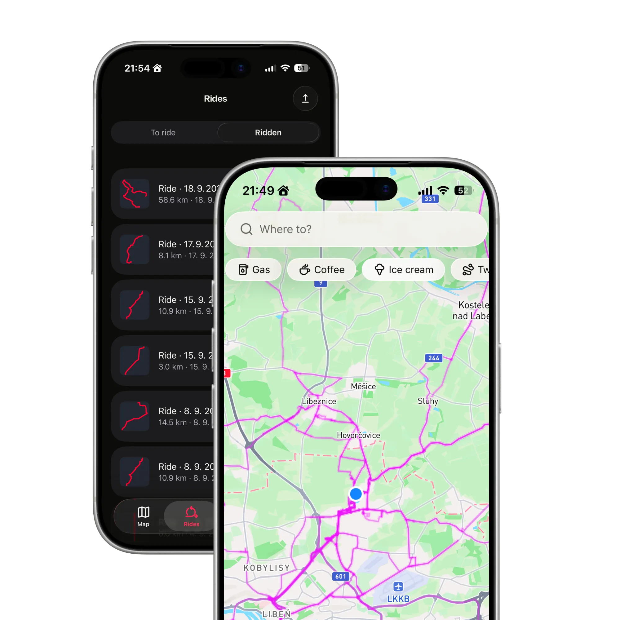
The Rides list on the Ridden tab, and in front of it the heatmap those rides draw across the north of Prague

On your phone, at a glance

The heatmap is ready the moment the map opens and needs no connection; it glows on the idle map and never gets in the way.

  • Zoom out for the whole network. Continuous lines across the country.
  • Switch it off for a clean map. My ride heatmap, in Map settings.
  • Nothing to tap. The heatmap is for looking; re-riding lives in your rides.
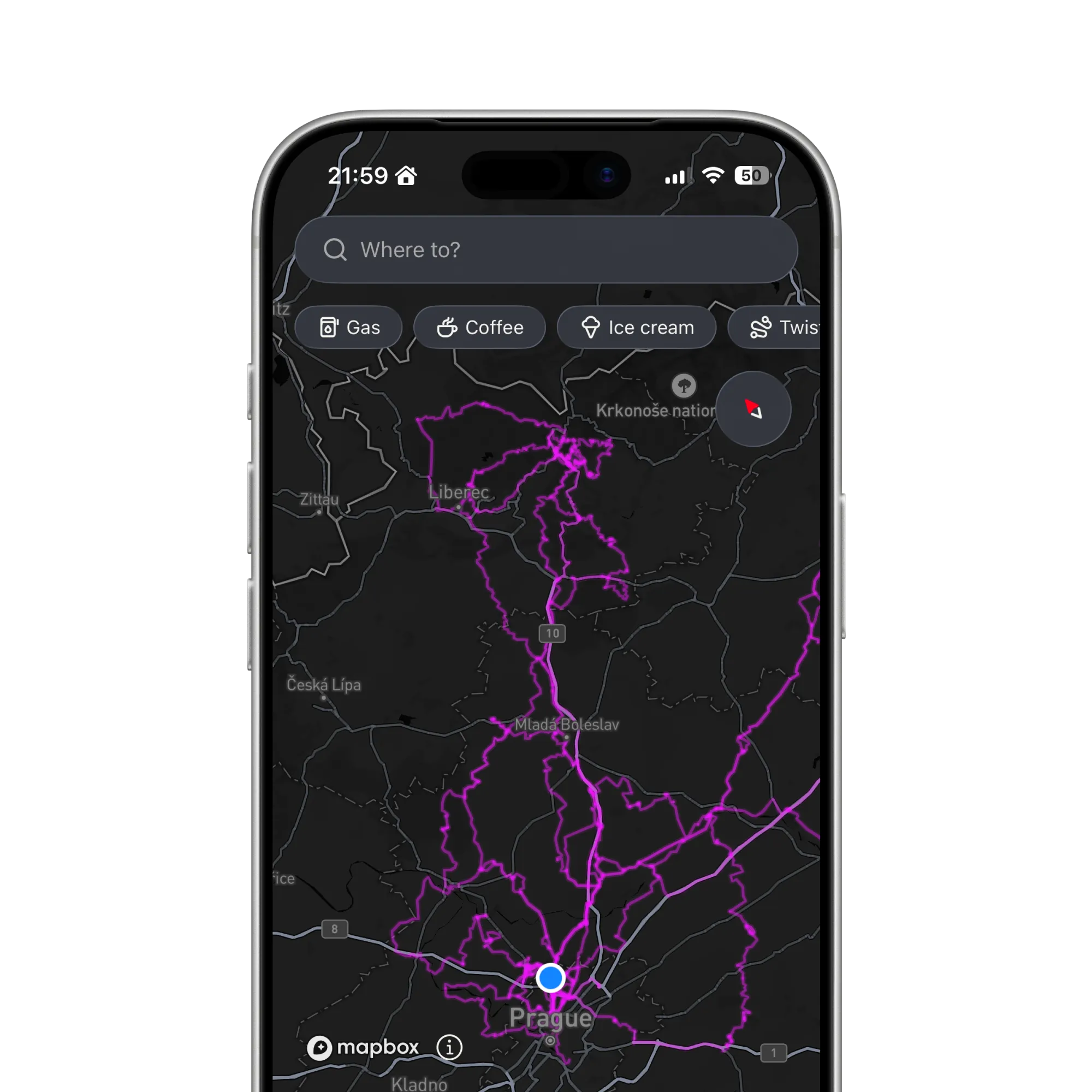
The map as it opens, in the dark style, with the heatmap reaching from Prague north to Liberec and the Krkonoše mountains

Start filling the map

Record the rides you take this season and watch your own roads light up, one weekend at a time.

Get the app
Night aerial view of country roads glowing red between dark fields and villages
FAQ

Questions about the heatmap

Straight answers on what counts, where it lives and how it stays clean. The support page has the rest.

All questions and support

Do imported GPX routes show in the heatmap?

No. The heatmap is built only from rides you recorded on your phone. Importing a file, or planning a route, is not evidence you rode it.

Does the heatmap need a signal?

No. It is computed on your phone from your own rides and is ready the moment the map opens, offline included.

Why is a stretch drawn as a loose line beside the road?

Because there was no road under you there: a field, a gravel cut, a trail the map does not know. Where you rode a real road, the heatmap snaps to it; where you did not, it keeps your line as you rode it.

Can I hide it?

Yes. The My ride heatmap switch in Map settings turns the overlay off and on.

Does it sync between devices?

Yes. Your rides and heatmap back up with your account, and a ride recorded on another iPhone appears once it has synced down.

Who sees my heatmap?

You. It is built from your rides, for you. Rides are never sold and never used for third-party advertising; the Privacy Notice lists every provider involved.

Ready to ride?

  • Plan it.
  • Ride it.
  • Remember it.
Download on the App Store

Fourteen days free. Questions or feedback? Get in touch

© 2026 ArcRoute. Made by in Czechia.